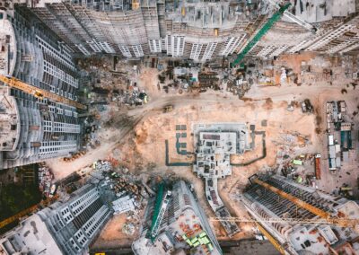
Integrating Big Data with GIS: A Game-Changer for Urban Planning
Transforming Urban Landscapes with Big Data and GIS
Big Data and GIS Integration is revolutionizing urban planning and spatial analysis, especially in rapidly developing regions like Saudi Arabia and the UAE. As cities like Riyadh and Dubai expand, the need for effective urban planning becomes paramount. The integration of big data with Geographic Information Systems (GIS) offers a powerful tool for city planners and management consultants to design smarter, more efficient urban spaces. By leveraging vast amounts of data from various sources, planners can gain unprecedented insights into urban dynamics, helping to optimize infrastructure, enhance service delivery, and improve the quality of life for residents.
Big data provides a wealth of information, including real-time traffic patterns, population demographics, and environmental conditions. When this data is integrated with GIS, it creates dynamic maps and models that offer a comprehensive view of urban environments. This synergy allows for more precise and informed decision-making. For example, in Riyadh, where rapid urbanization is underway, GIS integrated with big data can help identify optimal locations for new public services, predict traffic congestion, and plan for sustainable development. Similarly, Dubai’s ambitious smart city initiatives are heavily reliant on such technologies to manage their complex urban ecosystems.
Moreover, the integration of big data and GIS supports better communication and collaboration among stakeholders. Executives, mid-level managers, and entrepreneurs can access detailed visualizations and analyses that are easy to understand and interpret. This transparency fosters more effective communication, ensuring that all parties are aligned in their vision and strategies. For business executives in the UAE and Saudi Arabia, this means making more strategic decisions that align with long-term urban development goals.
Advanced Technologies in GIS and Big Data Integration
The integration of Artificial Intelligence (AI) and Blockchain with big data and GIS is pushing the boundaries of what is possible in spatial analysis and urban planning. AI algorithms can process and analyze large datasets more efficiently than traditional methods, uncovering patterns and trends that might be missed by human analysts. In Dubai, AI-powered GIS systems are used to monitor and manage the city’s energy consumption, water usage, and transportation networks, making the city more resilient and sustainable.
Blockchain technology adds an additional layer of security and transparency to data management. By creating immutable records of data transactions, blockchain ensures the integrity and authenticity of information used in GIS applications. This is particularly important for urban planning in cities like Riyadh, where accurate and reliable data is crucial for making informed decisions. Blockchain can also facilitate better collaboration by providing a secure platform for sharing data among various stakeholders.
Furthermore, the rise of the Metaverse and Generative Artificial Intelligence is opening new frontiers for urban planning and spatial analysis. The Metaverse offers a virtual environment where urban planners can simulate and visualize different development scenarios, providing a sandbox for testing ideas before implementing them in the real world. Generative AI can create complex models and simulations based on vast amounts of data, allowing planners to explore a multitude of possibilities and optimize their designs.
Leadership and Project Management in the Age of Big Data and GIS
Effective leadership and project management are essential for harnessing the full potential of big data and GIS integration. In the dynamic business environments of Saudi Arabia and the UAE, leaders must be adept at navigating technological advancements and guiding their teams through change. Executive coaching services play a critical role in developing these leadership skills, helping executives to stay ahead of the curve and drive successful projects.
Leadership in this context involves fostering a culture of innovation and continuous improvement. Managers must be open to adopting new technologies and methodologies, and they must be able to inspire their teams to embrace these changes. In Riyadh and Dubai, where rapid development is the norm, this kind of leadership is crucial for maintaining a competitive edge and achieving business success.
Project management also requires a strategic approach to integrating big data and GIS. This involves setting clear objectives, managing resources efficiently, and ensuring that all stakeholders are aligned and engaged. Effective communication is key, as it ensures that everyone involved in the project understands the goals, processes, and expected outcomes. In the UAE and Saudi Arabia, where ambitious urban development projects are underway, effective project management can make the difference between success and failure.
#BigData #GIS #UrbanPlanning #SaudiArabia #UAE #Riyadh #Dubai #AI #Blockchain #Metaverse #Leadership #ProjectManagement


