-mono-white MH-cropped-h99")

Integrating Advanced Technology for Comprehensive Storm Management
Real-Time Monitoring and Visualization of Storm Risk Areas
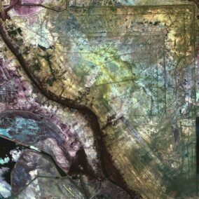
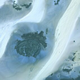
The integration of storm tracking technology with GIS has revolutionized the way we monitor and analyze storm risk areas. In Saudi Arabia and the UAE, leveraging these advanced technologies is crucial for effective disaster management and ensuring the safety of vulnerable populations. By combining real-time data from storm tracking systems with the spatial analysis capabilities of Geographic Information Systems (GIS), authorities can visualize storm patterns and predict potential impact zones with unprecedented accuracy.
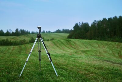
In regions like Riyadh and Dubai, where rapid urbanization increases the vulnerability to storm-related disasters, real-time monitoring systems are indispensable. These systems utilize a network of sensors, satellites, and radar technologies to track storm development and movement. The data collected is then integrated with GIS platforms to create detailed maps that highlight high-risk areas. This visual representation of storm data enables decision-makers to implement targeted interventions and allocate resources efficiently, ultimately mitigating the impact of storms on communities and infrastructure.
Moreover, the use of artificial intelligence and generative artificial intelligence in storm tracking technology enhances the predictive capabilities of these systems. AI algorithms analyze historical weather data and current storm conditions to generate accurate forecasts. By integrating these forecasts with GIS, authorities can simulate various storm scenarios and assess the potential impact on different regions. This proactive approach allows for better preparedness and response strategies, ensuring the safety and resilience of urban areas in Saudi Arabia and the UAE.
Protecting Vulnerable Populations through Advanced Technology
Protecting vulnerable populations during storm events is a critical aspect of disaster management. The integration of storm tracking technology with GIS provides valuable insights into the areas most at risk and the populations that may be affected. In Saudi Arabia and the UAE, where diverse communities reside in both urban and rural settings, this technology is essential for ensuring comprehensive protection measures are in place.
GIS platforms allow for the overlay of demographic data on storm risk maps, highlighting areas with high concentrations of vulnerable populations, such as children, the elderly, and those with limited mobility. By identifying these at-risk groups, authorities can prioritize evacuation plans, allocate emergency resources, and establish temporary shelters in safe locations. This targeted approach not only enhances the effectiveness of disaster response but also ensures that the needs of the most vulnerable are addressed promptly.
In addition to emergency response, the integration of storm tracking technology with GIS supports long-term planning and resilience building. Urban planners and policymakers can use this data to design and implement infrastructure projects that reduce the risk of storm damage. For example, flood control measures, storm-resistant building codes, and improved drainage systems can be developed based on the analysis of storm risk areas. By incorporating these considerations into urban development plans, cities like Riyadh and Dubai can enhance their resilience to future storm events and protect vulnerable populations.
Harnessing Modern Technology for Business Success and Leadership
The adoption of storm tracking technology with GIS is not limited to disaster management; it also plays a vital role in business success and leadership. Companies operating in storm-prone regions of Saudi Arabia and the UAE can leverage these technologies to safeguard their assets, ensure operational continuity, and enhance their reputation for resilience and sustainability. By investing in advanced monitoring systems, businesses demonstrate a commitment to proactive risk management and environmental stewardship.
Business executives and mid-level managers must be equipped to navigate the complexities of integrating storm tracking technology with GIS. This requires a thorough understanding of the capabilities and applications of these technologies, as well as strong leadership and project management skills. By fostering a culture of innovation and resilience, leaders can ensure that their organizations are prepared to handle the challenges posed by severe weather events.
Project management is another critical component in the successful deployment of storm tracking technology with GIS. Managers must oversee the installation and maintenance of monitoring systems, coordinate with technology providers, and ensure seamless integration with existing infrastructure. By utilizing real-time data and spatial analysis, project managers can optimize resource allocation, streamline operations, and enhance overall storm resilience. In the competitive business environments of Riyadh and Dubai, effective project management is essential for achieving long-term success and sustainability.
Conclusion: Building a Resilient Future with Storm Tracking Technology and GIS
As we look to the future, the integration of storm tracking technology with GIS represents a significant advancement in disaster management and resilience building. The ability to visualize and analyze storm risk areas in real-time is crucial for protecting vulnerable populations and ensuring the safety of communities in Saudi Arabia and the UAE. By leveraging the capabilities of artificial intelligence, blockchain, and the metaverse, these regions are setting an example for the rest of the world in effective storm management.
For business executives, mid-level managers, and entrepreneurs, the adoption of storm tracking technology with GIS offers substantial benefits. By incorporating these advanced systems into their operations, businesses can protect their assets, maintain operational continuity, and enhance their reputation for resilience and sustainability. Strong leadership and effective project management are essential for navigating the complexities of storm management and ensuring the success of these initiatives.
In conclusion, the advancements in storm tracking technology and GIS integration are crucial for building a resilient future. By embracing modern technology and fostering collaboration among stakeholders, Saudi Arabia and the UAE are leading the way in innovative storm management. As we continue to explore the potential of artificial intelligence, blockchain, and the metaverse, the possibilities for enhancing storm management and ensuring business success are truly limitless.
#StormTrackingTechnology #GISIntegration #StormRiskAreas #VulnerablePopulations #RealTimeMonitoring #DisasterManagement #SaudiArabia #UAE #Riyadh #Dubai #ArtificialIntelligence #Blockchain #TheMetaverse #GenerativeAI #ModernTechnology #BusinessSuccess #LeadershipSkills #ProjectManagement